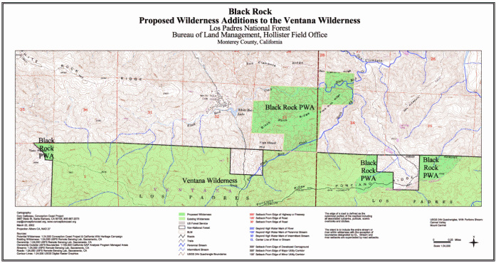
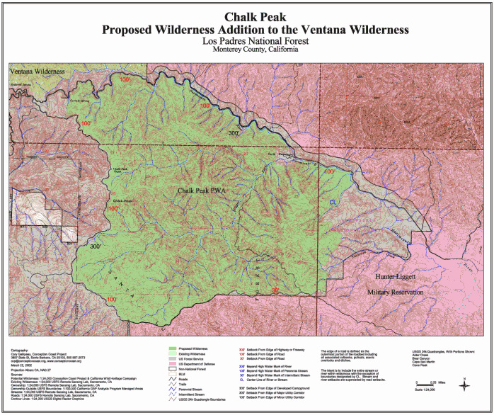
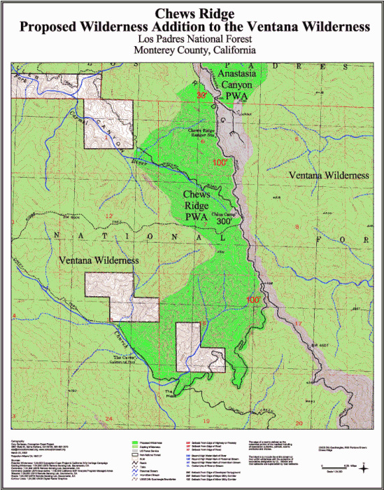
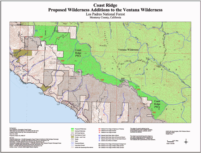
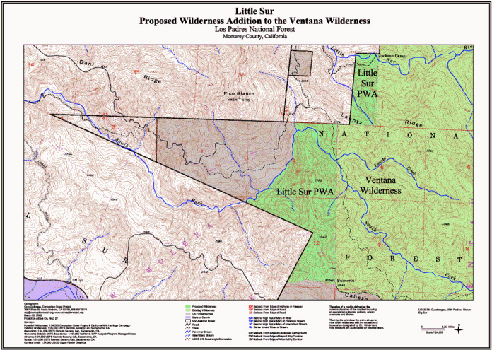
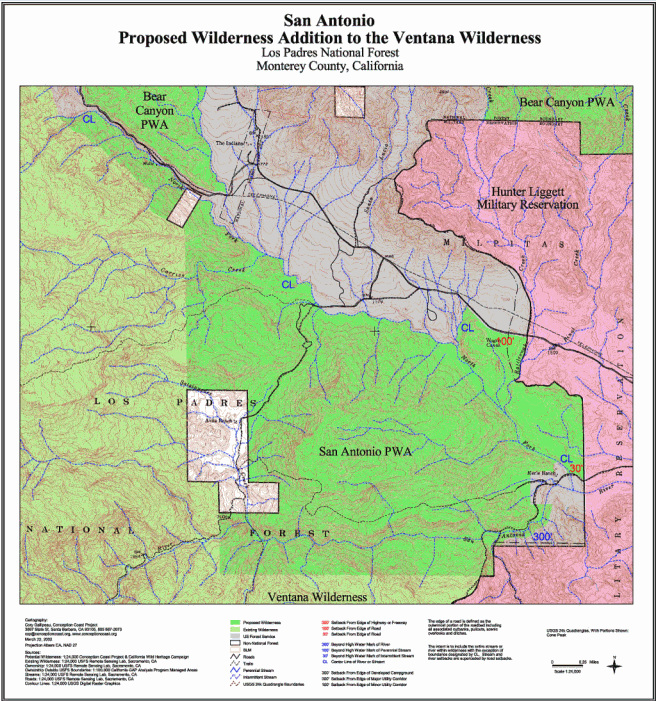
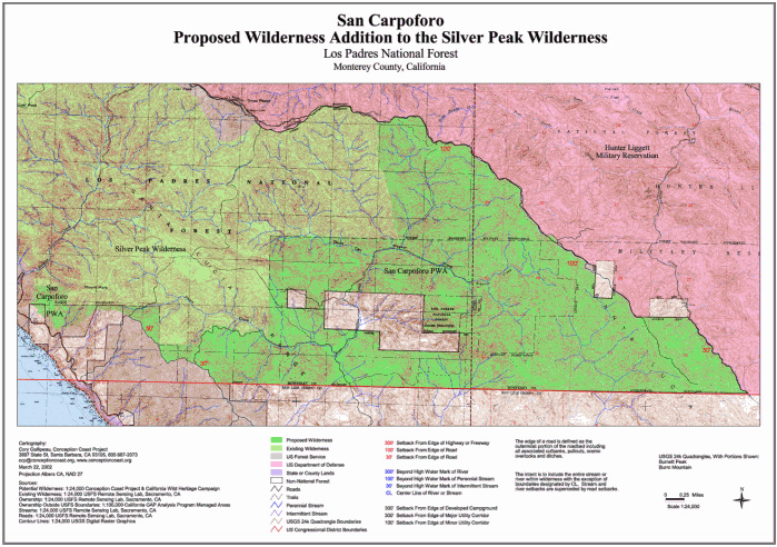
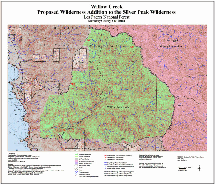
Maps of 2002 wilderness additions
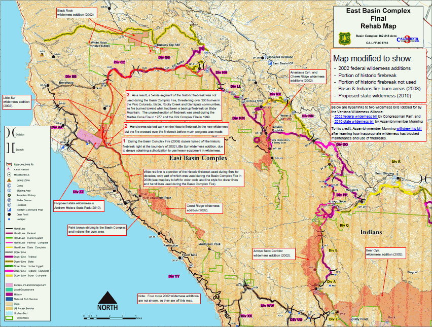
The map immediately below shows where some of the 2002 wilderness additions were located in context with firebreaks and the burn area of the Basin Complex and Indians fires of 2008, and some of the consequences. Click on the thumbnail to see the full size map in pdf, which you can zoom into for details like road and creek names (2.2 MB).
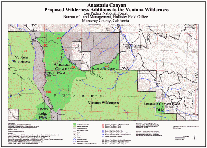
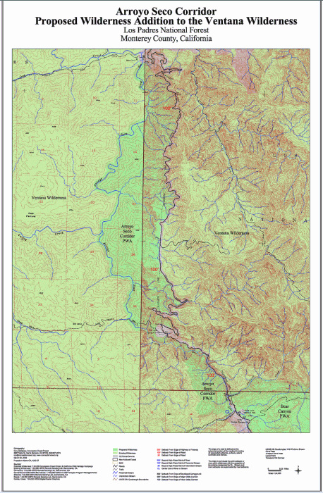
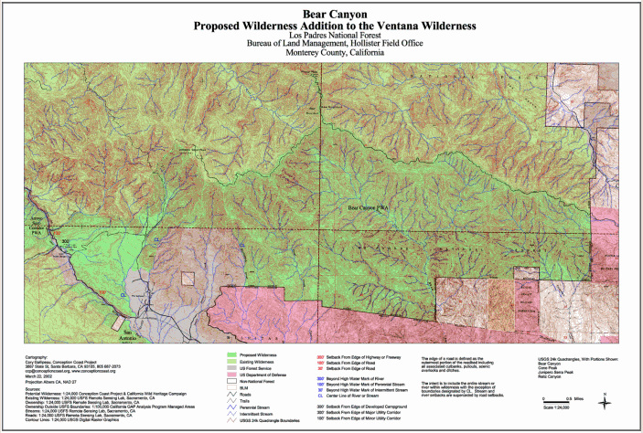
Further down the page are maps of each of the wilderness additions made by the Big Sur Wilderness and Conservation Act of 2002. The references to proposed wilderness are because the maps were made before the legislation was enacted. You can click on each map's thumbnail to see a larger version. The brighter green areas are the 2002 additions to wilderness.